Monday 27 February 2012

Mix of Sun and Snow Over the Next Few Days

     Sunday's storm made a mess of the roads across southern Manitoba. Blowing and drifting snow severely reduced visibility at times. Overall, my forecast was pretty accurate with 2-5 cm around the city of Winnipeg, while closer to 5-10, or even 15 cm along the US Border. Much higher amounts of 10 to 25 cm were reported in many areas of Alberta and Saskatchewan Saturday with the same system.

Snowfall totals with Sunday's storm

South Winnipeg      4 cm
Charleswood          4.4 cm
Steinbach               4.0 cm
Winkler                   14 cm
Altona                     10-15 cm
(Source: A Weather Moment)
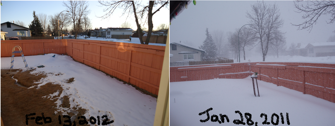
Blowing and drifting snow yesterday carved out some nice drifts
Roads are slippery and snow covered
     The next system of concern is a major Colorado Low set to begin developing tomorrow. There lies great uncertainty as to just how far north the system will extend. Therefore, it is a situation of either we get a moderately significant snowfall, or nothing at all.

     Either way, the bulk of the storm will stay to our south in North Dakota, Minnesota, Wisconsin and South Dakota. Locally 20-30 cm of snow is not out of the question in those states. That will be associated with strong winds of 40 to 60 km/h locally. Blizzard and winter storm watches and warnings have been issued for much of those areas. This will definintely be the strongest winter storm in the region since last winter. If you have travel plans in those areas over the next couple days, consider postponing or cancelling those plans if it is not absolutely necessary that you go. It will definitely be quite the storm, the one storm that is likely not worth underestimating.

     Back in Manitoba, it is tricky. It likely wont be a major storm for us, though accumulations of 5-10 cm is not out of the question near the US Border. Snowfall amounts will likely decrease sharply the farther north you go. Only 1-3 cm is expected for Winnipeg at this point. Moderately strong winds from the north will likely cause some drifting snow as well. A more detailed forecast will be provided tomorrow.
Current expected track of Colorado Low from Tuesday to Thursday

     Later in the week, yet another system. This time it appears both an Alberta Clipper and Colorado Low could form. These setups are often fairly difficult to predict, and often fool the models. The transfer of energy and moisture from the Colorado Low to the Clipper is often hard to predict. At this point, it appears like we may see about 2-5 or 5-10 cm in most of southern Manitoba Friday, but that could change as the week goes on.
    

Tuesday 21 February 2012

Snowstorm Summary

Sprague, Manitoba, by Robin Milne. Pic sent to TWN.
     The heaviest snowfall of the winter paralysed south eastern Manitoba today with up to 20 cm of snow in some locations. This significant snow storm was thanks to a Colorado Low which fed a developing low in North Dakota. Snow began pushing into the province yesterday afternoon, and slowly moved northwards throughout the night. Thanks to temperatures near the freezing mark, the snow was extremely wet, heavy and was sticking to everything creating a fantastic winter wonderland scene as seen in the photo to the right. Snow fell intensely at rates of 2-3 cm/hour in some cases last night.
     Snowfall was even mixed in with some light rain and drizzle at times yesterday afternoon and evening, though did not accumulate to much.
     The next 2 images below summarise snowfall totals in Manitoba, south of the border and in the Winnipeg area:
Snowfall totals in south east Manitoba and south of the border
Winnipeg 2-10 cm               Lancaster, Minnesota 20 cm
Landmark 14 cm                Crookston, Minnesota 15 cm
Beausejour 10-15 cm             Warren, Minnesota 13 cm
Pinawa 11 cm                            Grand Forks, ND 10 cm
                                       Indian Bay 12 cm
                                       Steinbach 21 cm
                                       Woodridge 20 cm
Snowfall totals in the Winnipeg area. Click on image to enlarge.
WPG Airport 2.0 cm
Charleswood 3.8 cm
Downtown 3.0 cm
St. Boniface 6.3 cm
River Park South 9 cm
Oakbank 12 cm

     There was a sharp cut-off in precipitation west of the RRV with little to no snow at all in areas such as Portage, Morden and Carman.

     The storm caused very dangerous driving conditions with numerous collisions, and a few power outages. The storm has also been blamed on a fatal collision near the corner of the Perimeter and Lagimodière where one woman lost her life. Fog, poor visibility, blowing snow and ice combined to create these dangerous highway conditions. It is advised you do not travel tonight unless you absolutely need to. A link to the latest highway conditions can be found under 'MB highway conditions' in my list of links on the right hand side of this blog.

     The extensive snow cover we now have could very well keep our temperatures a little cooler over the next few weeks even with a southerly wind, since snow is all the way down south of the border as well. Of course that cannot be guaranteed. This winter has already been full of surprises. A westerly wind could still keep us warm, thanks to the limited snow cover which still exists in the western RRV. It does not appear things will really begin to cool down until the weekend though, thanks to cloud cover and low pressure system over the next few days. Widespread flurries are possible everyday this week until the weekend, though accumulations should remain minimal.

     It now appears our idea of an early spring in late February or during the first week of March will remain a fantansy.. :(

Significant Snow Storm Tapering Off Slowly

Steinbach this morning (From 'Sarah'). I don't
take any credit for this photo
     Well, winter seems to have arrived! It looks like a winter wonderland out there today.

     My snowfall forecast map ended up pretty accurate, except that amounts were even more narrow than expected. Careful shoveling out there today, it's heart-attack type snow! Very wet and very heavy.

     Here are some unofficial snowfall amounts from environment canada as of 8 AM this morning. I'm guessing they will likely give final totals later this afternoon or evening.

Snowfall as of 8 AM

Steinbach      18 cm (As of 10 AM) (courtesy of Scott from A Weather Moment blog)
Oakbank       12 cm
Pinawa          11 cm
Beausejour    10-15 cm

Winnipeg
Far west end              1-2 cm
Charleswood             1.4 cm  (Courtesy of Rob from Rob's Blog)
East/south end           6-8 cm
St. Boniface               4 cm  (Courtesy of Brad from AWM)
My yard-south end     7 cm

Radar estimate of precip. amounts past 24 hours (as of noon)
      In the radar image above, generally you can say 10 mm = 10 cm for simplicity. Although, of course higher amounts were measured in some areas, the radar isn't 100% accurate. The image gives a good idea of how sharp the snowfall was. Little to no snow in areas as close as Elie, while closer to 10 cm in south Winnipeg. Winnipeg ended up really being the dividing line overnight.

     Today, snowfall is more widespread, and has already begun to taper off slowly. We likely wont be done with these flurries until tonight. It will be unsettled over the next few days, with chances of snow each day until the weekend.


Monday 20 February 2012

Significant Snowfall Tonight

     Well, the consensus seems to have arrived, now that the system is drawing near. Snowfall and even some rain has already begun southeast of Winnipeg, and will begin developping around Winnipeg early this evening. Rain has already begun falling in parts of the city this afternoon ahead of the main area of snow. In fact, as I write this, it is raining lightly outside my window in the south end. Incredible weather today, feels like March. Snow depth has dropped a good 2 or 3 cm today thanks to abundant melting. It may not seem like a lot, but there really wasn't much snow on the ground to start with.


     As for the storm, snow has crossed the international border into southeast Manitoba, and it should begin in the city by early evening and really get going by mid evening. Exact accumulations are still uncertain for areas RRV and west, again because of the narrowness of the area of snow. Areas southeast of WPG are pretty much guaranteed to see 10 or more cm of snowfall. Here's a map below that I've prepared showing how much snowfall I am predicting with this system:


     As you can see, it is a tough forecast to make since snowfall amounts drop off so rapidly west of the system. If the snow ends up being a little further east than expected, Winnipeg could end up in the 2-5 cm zone, while if the system moves a little farther west, we would end up with closer to 10-15 cm. At the moment I am leaning towards 5-10 cm for the city. It will be a very wet snow, therefore blowing snow should not be a major issue with the strong NW winds expected tomorrow. It should still be quite mild with temperatures just slightly below zero tonight and tomorrow.

     Remember that lonely snow shovel? Looks like you'll finally be able to take it out! :P

Sunday 19 February 2012

Pleasant Sunday, Unsettled Week Ahead

     Our warm winter continues for a couple more days before things begin to cool down later this week.

     It will start off quite sunny this morning, although high thin cloud will be increasing throughout the day today. It wont be full out cloudiness, rather a more filtered sunshine/mix of sun and cloud. Temperatures will be very pleasant thanks to a nice southerly flow of air. Despite a bit of cloudiness, I think most areas will reach or exceed the freezing mark today, especially over bare ground where there is little to no snow cover. Areas in the eastern RRV may have a bit of trouble exceeding zero thanks to snow cover, although there is still a chance. Here's what I'm predicting for today from east to west:

Steinbach 0 to 2°C
Winnipeg 0 to 2°C
Western RRV 2 to 6°C in general
Brandon 0 to 2°C

     Winds will be relatively light from the south at around 20 km/h. That continued wind and cloud cover overnight will allow for warm overnight lows around -5°C in Winnipeg.

     The rest of the week remains quite uncertain. Tomorrow and Tuesday specifically are very uncertain still at this point as a more organised system from the states moves north into NW Ontario. Models are bouncing around with scenarios, and there are some big differences among them as well. What is clear though is that it will be an unsettled week, with cooler temperatures beginning late-week.

     Personally, I am leaning towards more of a grazing-type situation, where snow will just graze southeast Manitoba with a few cm. Another area of snow from the west could give southern Manitoba periods of light snow Monday night and Tuesday with 1-3 cm. There is great uncertainty at this point, so stay tuned for the latest updates as the situation gets clearer.
     Below: Here's how much precipitation two different models are predicting for Monday and Tuesday. As you can see, the two are giving very different solutions showing the great differences that lie:
GEM Regional showing SE MB getting the heaviest snow
NAM showing southern MB completely missing out on US storm
but seeing some flurries on the back-side
      Another clipper system threatens to bring us more snow Thursday, although that is a little far off to draw to conclusions, especially when you consider tomorrow is uncertain! After warm temperatures Monday and Tuesday, it will cool off slightly to the minus single digits Wednesday, and warm slightly again Thursday with the clipper system, then cool off back to near normal or even a bit below by Friday and the weekend.

Monday 13 February 2012

Spring-Like Week

     Our intriguing winter continues to intrigue with yet another week of above-normal temperatures and lack of snow pack on tap. It was a wonderful Sunday and Monday with highs between -2°C and 0°C along with light winds. This is much above the normal high of -9°C.

     Even warmer temperatures were felt on Monday to the southwest of the city where snow is almost non-existent, as seen in the visible satellite below. Highs were above zero in many areas, including +4°C in Carman, +3°C in Pilot Mound and 0°C in Brandon.
Dark areas to the southwest of WPG indicate bare ground. White areas in parts
of ND and southeast SK are just cloud. Ground is pretty bare there as well.
     Snow depth at the Brandon Airport today is just 1 cm. Here in Winnipeg, the snow depth is about 6 or 7 cm (measured in Charleswood). For comparison, this is the third lowest snow depth on February 13 since snow depth records began in 1955. First and second place honours for today go to 1991 with 4 cm and 1999 with 6 cm.
    
     What little snow is actually on the ground this week will be slowly melting thanks to mild temperatures which are making it look and feel a lot more like March. At this time of year, we are normally in the dead of winter with our deepest snow depth of the winter. This winter has other plans...
What little winter we had is slowly melting away...  =)
     What a difference a year makes. This day last year, the snow depth was 34 cm. Here's a comparison of pictures I've taken in the same spot comparing last year and this year (not exactly same date, though it gives a good idea).

     This spectacular weather will continue through the rest of the week. Overnight lows will be a little chilly in the minus teens, although daytime highs will be terrific near the freezing mark, and even a little above on some days and in some areas, mainly in areas where snow is almost non-existent. The only downside will be that cloud will begin to move in tomorrow. It wont be perfectly sunny tomorrow or Wednesday; it will be more of a mix of sun and cloud. We may even see a little snow Thursday and Thursday night, though it will be very light with likely just a dusting.

     Temperatures look to cool down by the weekend, although it will likely just be closer to normal. Any cool down will be brief with what appears to be another warm up to start next week.

     In case you were wondering how this winter is doing in the record books so far, here's a glimpse.

     So far (up to Feb 12), this winter's average mean temperature is -10.2°C. If we manage to maintain that average mean, this would be the 5th warmest winter on record since records began in 1873. Of course, it is unlikely we'd maintain that average, athough it is very likely this winter will end up being somewhere between the 4th and 7th warmest on record.

Top 10 warmest winters since 1873
Mean temperature        Year

1.   -7.2°C               1877/1878
2.   -8.2°C               1997/1998
3.   -9.5°C               1986/1987
4.   -10.1°C             1930/1931
5.   -10.8°C             1991/1992 and 2005/2006
7.   -10.9°C             1982/1983
8.   -11.6°C             1999/2000
9.   -11.7°C             1939/1940 and 2001/2002             

    Interesting how 5 of the top 10 warmest winters were in the past 20 years... This year would make that 6.

     In addition, only 48.0 cm of snow has fallen so far this winter, which is well below the normal 75 cm we would have normally seen by now. I am still gathering the stats for least snowy winters, and will likely have those stats by the end of the month.

Friday 10 February 2012

Actual Temperature vs. Wind Chill - common mistakes

     A quick interruption on the current weather story to give a quick little lesson on wind chill.

     Since it is on days like these that many people mix up temperature and wind chill, here's a quick reminder about the difference, and what NOT to say...

     It is very important to keep in mind that wind chill is not the actual temperature. So for example, saying ''it got down to -40°C this morning in the city'' is INCORRECT. It is so common to hear this mistake, especially in the media.

     So basically, while the ACTUAL temperature was -28°C this morning, with the wind, the wind chill was -40. That means that with the wind blowing on you, it would feel like your body was losing heat as quickly as if it were -40°C with calm wind. This is because the wind takes away at the thin warm layer of air just above our skin created by our body.

     But that wind chill value is felt only when the wind is blowing on you. Therefore, if you're outside and no wind is blowing on you, it would just feel like the actual temperature, which was -28°C. That is why it is incorrect to say that it was -40°C this morning, rather it was -28°C with a -40 wind chill.

     There is another error associated with wind chill, which is putting a °C with the value (example:  -40 °C wind chill). Wind chill is not measured, rather it is calculated using the actual current temperature and the wind speed. Since it is not measured, no units are added since it is only a value representing the COOLING RATE expressed in terms of an equivalent temperature.

     Hopefully that makes sense, I tried to make it as simple as I possibly could..  =)


     Bonus info... If interested, in Canada, this is the formula for calculating the wind chill: It looks complicated, but it is actually quite simple. Ta = actual air temperature (°C),
V = wind speed (km/h), and Twc = wind chill value. Just add the air temperature and wind speed in the formula then get the calculator out :)

Twc = 13.12 + 0.6215 Ta – 11.37 V+0.16 + 0.3965 TaV+0.16

Thursday 9 February 2012

Bundle Up... For Now

     The cold front went through early this morning ushering in frigid arctic air and strong gusty winds. Winds will be from the north at 30 to 40 gusting to 50 or 60 km/h much of the day today, and temperatures will continue to fall slowly, getting closer and close to -20. These are creating significant wind chills in the -20s today, with wind chills in the -30s and approaching the -40 mark tonight and tomorrow. Be sure to bundle up!

     Tonight could potentially be our first -30 C of the winter, although it will be a close call. Most forecasts call for lows near -27 to -29 C. It wont warm up very nicely tomorrow, with highs barely exceeding -20 C. At least it will be sunny and winds will be lighter than today... :)

Friday morning temperatures - GEM model. Source - link on right hand side of blog as well -->

     Saturday morning would be the next chance at -30 C if we don't hit it Friday morning, although the chance Saturday is lower. Winds switching to westerly will likely keep them from plummeting too low Saturday morning. Those westerly winds will warm us up for the weekend with highs Saturday likely closer to our normal high of -9 C, with highs near -11 or -12. Sunday will mark the return to slightly above normal temperatures in the minus single digits.

     So this arctic outbreak will be fairly short lived with temperatures likely to remain above normal throughout much of next week, good news if you want our warm winter to continue to live up to its name.

     Meanwhile in other news, the cold arctic arctic air needs to be somewhere, and if it isn't significantly present here, then where is it? Europe has been having brutal cold and snow in the past couple weeks, and that seems to be continuing in many areas. Ice has started to form along major rivers, including in Paris, meaning icebreakers have had to be used for the first time in several years. Link to this story below:
TWN - City of Paris dusts off its river icebreaker, Dutch skate on canals in Amsterdam

Sunday 5 February 2012

Super-Warm Sunday

     Another crazy day in Manitoba this winter with temperatures 15 to 20 C above normal today. Abundant sunshine and westerly downlope winds allowed for temperatures to rise well above zero. Most notable was in the western RRV. A few records were broken, although not many. Some areas were very close to breaking their records though. Winnipeg Airport's high of 6.8 C was just shy of the previous record of 7.2 C in 1963.

Records broken in Manitoba today:

Location . . . . . . . . . . Today's High . . . . . . . . . . Old record . . . . . . . . . . Records began

Pilot Mound                      8.8 C                            8.3 (1963)                            1939
Melita                                6.3 C                            1.7 (2002)                            1993
Fisher Branch                  5.6 C                            4.5 (1991)                            1978
Churchill                          -2.0 C                          -5.6 (1961)                            1932


Also some incredible highs which did not break records:

Location . . . . . . . . . . Today's High


McCreary                         9.9 C
Carman                           9.3 C
Portage                            7.9 C
Morden                             7.9 C
Gretna                              7.9 C
Winnipeg The Forks        7.6 C
Winnipeg A                      6.8 C
Brandon                           5.7 C
Pinawa                             5.0 C
Steinbach Ag                    4.9 C
Gimli                                 3.7 C

     Hopefully you got the chance to enjoy this spectacular day, because tomorrow is the beginning of a change. A cold front will swing through tonight ushering in drastically cooler temperatures behind it. Temperatures will likely steady or even continue to fall tomorrow afternoon into the minus teens by evening. Although of course, this is just closer to normal :P It will feel much colder with the wind, with blustery north winds of 40 gusting to 50 or 60 km/h expected. Tuesday will be closer to normal as well with morning lows approaching -20 C, and daytime highs struggling to reach -10 C.
Overnight tonight
     After a brief warm-up Wednesday with highs in the mid minus single digits, things will only get colder thereafter. Thursday through Sunday look downright frigid with lows well into the minus twenties and highs between -15 and -20 C.

     Next week looks like the return of above-normal temperatures, although as usual, stay tuned for the latest updates...

P.S. Very little in the way of snow expected in the next week.

Friday 3 February 2012

Fog in the Valley

     The skies just didn't quite clear as expected in the city today.

     Although, clearing was not far away. Regions as close as the western RRV cleared nicely today, which gave way to very warm temperatures. +5 in Portage , +6 in Morden and +7 in McCreary where it is sunny! The fog was able to clear out in those areas thanks to a westerly wind which dried things out.

Emerson late this afternoon

     Here in the bottom of the RRV, only got to -4 C in WPG, and the fog has just stayed put all afternoon locally. And locally is the key word, as the sun has showed in areas as close as Gimli, Steinbach and Emerson. The wind here has stayed southerly, not ideal for drying.

     Fog will likely rethicken again tonight, which will mark the 4th night in a row of dense fog and hoar frost... Fog should begin to clear tomorrow as winds begin to shift a little more westerly, although we'll have to wait and see.

Fog this morning in WPG. You can normally
see an open field in the background.
     Sunday will likely be the nicest day of the weekend. With winds picking up from the south west, the fog will be gone, allowing for very warm temperatures. The potential is there for temperatures of 2 to 4 C above zero if skies clear out as planned. Some areas, especially in the western RRV could get even warmer than that. Highs between 6 and 8 C are definitely a possibility. Our non-winter continues...

     Sunday night a cold front is expected to drift south from the north, allowing for temperatures to take a dive Monday. Very strong winds from the north are expected Monday, so expect it to feel much colder than we've been accustomed to. At this point, it appears lows near minus twenty are likely Tuesday morning so enjoy these warm temperatures while we still have them!