With the humidity will come an increased risk of thunderstorms. Wednesday, Thursday and Friday all have the possibility for storms, and some may be severe. They are expected to be pop-up type storms with no major large-scale triggers. As a result, they are expected to remain isolated, so not everyone will be seeing storms later this week.
 |
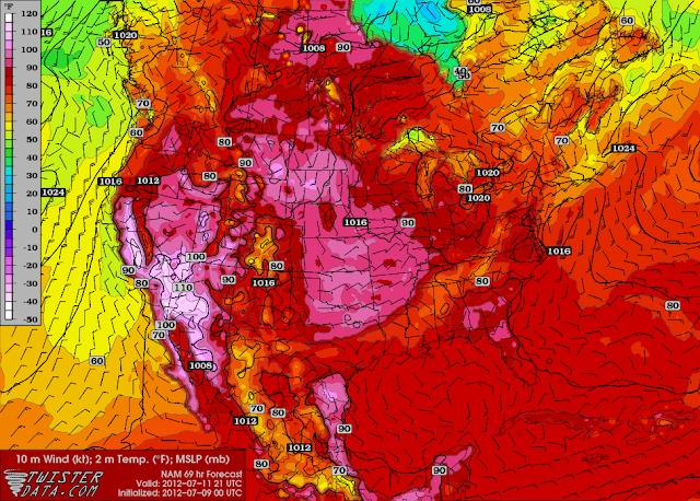
| Forecasted high temperatures for Wednesday July 11. Highs in the low to mid thirties expected for southern Manitoba. |
And there is currently no end in sight to the heat in southern Manitoba. All the models seem to point at above normal temperatures (over 26°C) continuing for at least the next 10 days, and perhaps even the next 14 days.
 |
| NAEFS Ensemble model points at a 90-100% chance of above normal temperatures in southern Manitoba from July 16 to 23. As a result, there is no end to the heat in the near future. |

This comment has been removed by the author.
ReplyDeleteAt this time, it appears the hottest day this week will Wednesday. Highs near 35°C will be possible throughout southern Manitoba. Parts of southwestern Manitoba and western RRV will have the chance at 36 or 37°C if current models are correct.
ReplyDeleteThat will be mixed with a bit of humidity as well. Humidex values in the low forties will be likely. This humidity and a shortwave in western RRV will allow for the potential for thunderstorms throughout southern and central Manitoba. An isolated severe storm will be possible due to high instability.
An isolated thunderstorm is possible in the Winnipeg area before sunset. They are generally weak storms with little lightning. Will let you all know if storms head our way.
ReplyDeleteCell has formed just to the south of the city. No lightning seen yet, but heavy rainfall is likely if you end up under the cell. This particular cell is not heading towards the city, however some rain is falling in the extreme south parts of the city.
ReplyDeleteThe risk of storms today is very small, smaller than yesterday's risk even. The best chance looks like the Interlake and western MB at this point. I will update if things change.
ReplyDelete