
 |
| June summary - Click to enlarge |
The month though, was a mixed bag. It started warm and stormy, with multiple thunderstorms in the Winnipeg area. 6 of the first 12 days of the month saw thunderstorms. It became even more unsettled, and much cooler mid month. Businesses who rely on warm and sunny weather suffered for a couple weeks, as skies remained mostly cloudy with daily rain events. In a period of 14 days from the 7th to the 20th, 13 of those days saw rainfall. Despite all the wet weather, we still saw below normal rainfall for the month. That is because we saw several light rain events instead of several heavy rain events.
Things brightened up late month however. Hot and sunny weather became the name of the game with a full week of sunshine and temperatures in the high twenties and near 30. This turn to summer-like weather creates some worries however. If these conditions continue into July, we could go back to another drought similar to last year's.
 |
| June 3 anvil over Winnipeg (looking west) |
As for thunderstorms, two events stood out in the month, namely June 3 and June 9.
A cold front sliced through southern Manitoba on June 3. Temperatures were hot, and humidity was high, and the cap was insignificant. As a result, strong storms formed along the front and moved east, in the afternoon and evening. One supercell-type storm formed near Elie and moved straight for the extreme south edge of Winnipeg. Due to low shear, tornadoes were not a big threat on this day. However, low shear meant slow-moving storms. 15-25 mm of rain fell in the heaviest hit areas, along with quarter-sized hail.
June 9 was an event to remember. The day started off with an MCS in southern Manitoba. It brought very strong winds in southwestern Manitoba overnight and early morning before weakening as it moved east. It brought very odd cloud formations to the Winnipeg area, as well a good dose of rainfall, and a few lightning strikes.
In the afternoon and evening, as skies cleared and temperatures rose, there was potential for a significant tornado outbreak thanks to a warm front and high shear. In anticipation of this, many storm chasers, including Reed Timmer, zeroed in on the International Border. Unfortunately (or fortunately), no tornadoes formed that day. Very large hail, incredible lightning and torrential downpours were the main stories.
A supercell moved right through the city of Winnipeg in the mid evening hours. Very large hail fell in the west end, with golf ball and tennis ball sized hail. Lightning was fantastic as well with almost constant flashes at times.
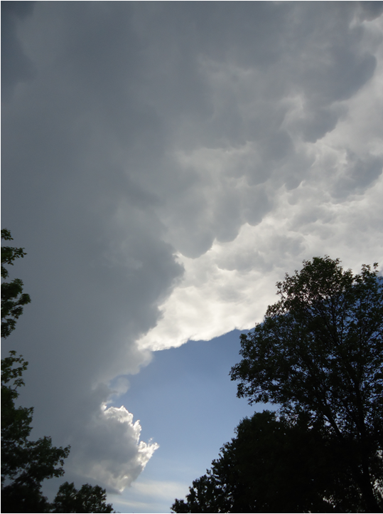
 |
| Morning MCS over Winnipeg. (left: mammatus ahead of storm, taken by me) (right: by Mary Ellen McMurtry) |
 |
| Evening supercell over Winnipeg. (left: by me) (right: by Amanda Smith) |
 |
| Incredible hail over Winnipeg, by Dennis Kurchaba |
We wont know for sure what will happen tomorrow until morning. Nocturnal activity is very difficult to predict.
ReplyDeleteI can say that there is a good chance of severe weather in southern Manitoba tomorrow if current models are correct.
Expect humidex values to rise near 40 in Winnipeg today. I'm actually thinking a humidex advisory would be good for Winnipeg today, which already has a humidex of 36 at 10 AM.
ReplyDelete